Showing posts with label Snow Lake. Show all posts

Sunday, August 21, 2011

On way to Guye Peak

Trail Distance: 4 miles out and back
Elevation Gain: 1600 ft


Guye Peak peeking in the distance
With the continuing nice weather that started right after my hike to Snoqualmie mountain last weekend, I returned to the same Aipental trail head, this time with friend Saranga, with the plan for scaling Guye Peak. Just like the Snoqualmie mountain, the Guye Peak is also a very prominent geological formation that draws travelers' attention without fail at the Snoqualmie Pass. Compared to Snoqualmie Mountain, Guye Peak is located closer to the highway, a little less in elevation, yet with equally magnificent views all around. Both destinations share the trail for about a mile or so up until the fork at elevation of 4200 ft where a marker shows directions to the two legs of the trail.The trail description upto this point is available in my previous blog entry.

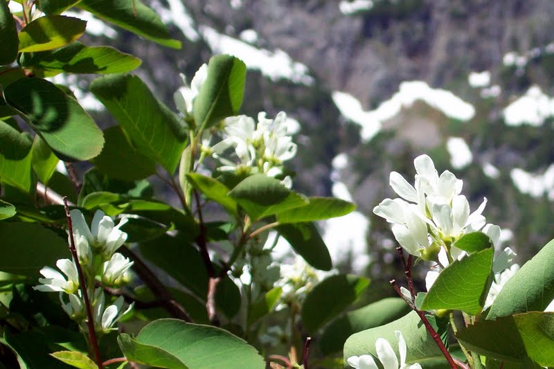
Gorgeous wild flowers

Almost immediately past the fork, the trail towards Guye Peak gets in and out of a rock scramble while climbing steeply. Soon afterwards, it climbs by the side of the mountain with southern exposure to nearby Danny Mountain. Then the trail enters a forested stretch where the slope becomes more manageable and reaches another fork with the other leg leading to Cave Ridge trail. Unlike the previous fork, however, there is no marker at this point. We continued towards Guye Peak and soon arrived at an plateauesque opening with a little pond and great views pf the Chair, Bryant and Tooth peaks beyond which lies the Melakwa Lake. We had a nice view of the Snoqualmie Mountain as well.

Tooth, Bryant and Chair peaks

The trail beyond the pond is rendered obscure by vigorous growth of the trees and abundant rockfalls. The gradient of the trail also became very severe all of a sudden through the next quarter of a mile or so. Unfortunately Saranga being a beginner hiker,  was not wearing proper hiking boots and we shared my one pair of tracking poles with one pole to each. The steep gradient seemed to be wearing him out as well. So out of safety concerns, we decided to call it quits at that point. It would have been just about 15 more minutes to the top from there, but we decided not to risk any injury and headed back.

Snoqualmie Mountain

On our way back, we met another hiker returning from the Cave Ridge Trail. I thought I found my next adventure for one of the following weekends.

Sunday, July 24, 2011

Source Lake and Snow Lake

The Source Lake from above
 Sunday,, July 24, 2011
Distance: 5 Miles Round trip
Cummulative Elevation Gain: 1500 ft

The weather was nice. Yet because of the late onset of summer this year, the snow has not melted at most of the usual destinations. Even at the Snoqualmie Pass area, a lot of snow was reported by other hikers earlier in the week. My friend Mrinal accompanied me on this hike. Mrinal has not hiked on snow before. As a safety precaution, we decided to hike the snow lake trail, which is a popular one with a lot other people around, at the same time, not too far off for a Sunday hike (Can not get too tired - got to get back to work tomorrow :-)). Another great reason to hike these areas now is the blooming wild flowers.

Beautiful mountainside and the trail
We were at the trail head at around 10.30 am. The very large parking area was about half full. There was a forest ranger hiking alongside and answering questions about trail conditions out in the wild. We learned from her  that the the north facing trail section that descends down to the Snow Lake beyond the saddle at 2.1 miles and 4400 ft elevation was still snow covered and almost un-surpassable using fair weather hiking gears only. So at the fork after 1.5 miles and 3700 ft elevation, we went on to explore the Source Lake view point. The trail actually runs much higher on the north flank of the mountain side of the valley. It is the Source Lake where the South Fork of the Snoqualmie river originates and after flowing over a few miles joins with the Middle and the North Forks near North Bend city. 

Magnificent wild flowers blooming
Part of the trail length leading to the Source Lake view point was snow covered. My fried was excited at the opportunity to walk on the snow. We were careful not to miss a step or put in a misstep. We saw two pairs of foot trails out on the snow covered southern flank of the stream and wondering if any hikers went hiking off trails. Then at the view point we met two women who were apparently lost and made those foot prints looking for a way to the snow lake. I told them about the fork about half mile back before settling down there to eat our snack and head back a little later.
  
Mrinal and I with Snow Lake In the backgrond

 Back at the fork, we now made it towards the Snow Lake. This trail segment was totally covered with snow. There were a lot of people out there. But most of them hung around at the ridge at 4400 ft. There was great view of the Lake down below providing some beautiful picture opportunities. However,  the trail beyond seemed to be buried in at least kneed deep snow just like we learned earlier from the forest ranger. So Mrinal and I agreed that this was our final destination and turned around for the trail head.

Hikers enjoying views of Snow Lake and beyond


Saturday, December 26, 2009

Middle Fork of Snoqualmie River

Saturday, December 26 2009
Cumulative Elevation gain 420 ft
Trail length: 13 miles loop
Level of difficulty: Medium
It was the day after Christmas and the sun was shining bright. I have not done much of winter hikes so far. So I talked to David for the possibility of another hike together. David has been hiking in the Puget Sound area for several years and knows details of many of the trails by heart. Even though it would not be his first time hiking the Middle Fork of the Snoqualmie river, he gracefully agreed to accompany me and here we set off again.
A section of the access road to the trail head was closed after damages during snowstorms last year but was apparently re-opened earlier this year. The last 5 miles of the road is still full of potholes. The road for most parts runs along the river as we passed those ragged tops of the Russian Butte and along the way witnessed some nice sights of Mount Garfield in the distance and snow covered trees by the riverside.

The trail head is located near a bend where the middle fork meets Taylor river while changing course from a north-westerly direction to south westerly. We pressed on as David wanted to check out the bridge over the Taylor river that leads to other spectacular destinations such as Snoqualmie Lake and Nordrum Lake. The bridge was gated for vehicular traffic but seemed to be fine for foot traffic. I shall probably in the summer to visit those lakes. But for now, we returned to the trail head of the middle fork. There was just one other car at the parking lot and two elderly gentlemen were getting ready for the hike.
Immediately beyond the parking lot, we crossed the middle fork river over a nice wooden bridge. The trail runs in a South-Easterly direction upstream along the valley of the Middle Fork river. There was only a very gentle elevation gain as we advanced. One gets spectacular glimpses of the Mount Garfield across the river. The ground had traces of snow all the way and some hard packed ice at some sections. The temperature was below freezing, yet it was not too cold to impede the enjoyment of hiking. At the six mile point, the trail splits. Continuing on the trail would take you to the Snow Lake. This would be an alternate way to get to the Snow Lake. The more popular trail for Snow Lake starts near the Snoqualmie pass. We followed the other leg of the fork to cross the bridge over the Middle Fork river and came upon the trail that follows the river on the north side. This is where another trail starts for the Myrtle Lake and Hester Lake - another couple of possible future destinations for me.

A little bit farther away is the bridge over the Dingford Creek which joins the Middle Fork river. We reached the bridge and enjoyed the cascading waterfalls on either side of the bridge before turning around to sit down near the Myrtle Lake trail head. There we rested a bit while eating snack lunch. We returned by this other trail that runs on an old forest logging road on the north side of the Middle Fork river. Some sections of the road is badly damaged and would not be negotiable by most vehicles. The trail is gated at the starting point to prevent any vehicular traffic.
It was a nice workout for a hiking in a winter day in December. It was cold but not much climbing was involved, and hence there was not much of a danger of falling down or getting injured. As we have found out, this is a trail that can be hiked safely all year round.

More Pictures