Showing posts with label North Bend. Show all posts

Sunday, July 24, 2011

Source Lake and Snow Lake

The Source Lake from above
 Sunday,, July 24, 2011
Distance: 5 Miles Round trip
Cummulative Elevation Gain: 1500 ft

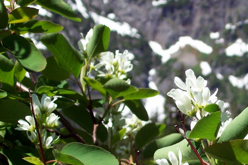
The weather was nice. Yet because of the late onset of summer this year, the snow has not melted at most of the usual destinations. Even at the Snoqualmie Pass area, a lot of snow was reported by other hikers earlier in the week. My friend Mrinal accompanied me on this hike. Mrinal has not hiked on snow before. As a safety precaution, we decided to hike the snow lake trail, which is a popular one with a lot other people around, at the same time, not too far off for a Sunday hike (Can not get too tired - got to get back to work tomorrow :-)). Another great reason to hike these areas now is the blooming wild flowers.

Beautiful mountainside and the trail
We were at the trail head at around 10.30 am. The very large parking area was about half full. There was a forest ranger hiking alongside and answering questions about trail conditions out in the wild. We learned from her  that the the north facing trail section that descends down to the Snow Lake beyond the saddle at 2.1 miles and 4400 ft elevation was still snow covered and almost un-surpassable using fair weather hiking gears only. So at the fork after 1.5 miles and 3700 ft elevation, we went on to explore the Source Lake view point. The trail actually runs much higher on the north flank of the mountain side of the valley. It is the Source Lake where the South Fork of the Snoqualmie river originates and after flowing over a few miles joins with the Middle and the North Forks near North Bend city. 

Magnificent wild flowers blooming
Part of the trail length leading to the Source Lake view point was snow covered. My fried was excited at the opportunity to walk on the snow. We were careful not to miss a step or put in a misstep. We saw two pairs of foot trails out on the snow covered southern flank of the stream and wondering if any hikers went hiking off trails. Then at the view point we met two women who were apparently lost and made those foot prints looking for a way to the snow lake. I told them about the fork about half mile back before settling down there to eat our snack and head back a little later.
  
Mrinal and I with Snow Lake In the backgrond

 Back at the fork, we now made it towards the Snow Lake. This trail segment was totally covered with snow. There were a lot of people out there. But most of them hung around at the ridge at 4400 ft. There was great view of the Lake down below providing some beautiful picture opportunities. However,  the trail beyond seemed to be buried in at least kneed deep snow just like we learned earlier from the forest ranger. So Mrinal and I agreed that this was our final destination and turned around for the trail head.

Hikers enjoying views of Snow Lake and beyond


Sunday, February 14, 2010

Mt Si in the Winter

Saturday, February 14, 2010
Cumulative Elevation gain 3700 ft


I am a bit wary of going off alone on any hiking trail during the winter season when the snowy reaches of the trails can sometimes be very treacherous. But I have found a dependable company in David who is a veteran of hiking: in pacific northwest and away, to peaks and lakes, during summer and winter. So off we go again - this time on another trip to Mt Si - in the winter. The trail description is not much different from the summer trips, except for the freezing temperature at the summit. And you really would not want to try to climb the Haystack scramble because the rocks get slippery in the icy conditions. In fact, someone fell and killed himself while climbing Haystack in adverse weather a couple of years ago. So we made it to the base of that scramble, had our snack lunch and returned. The new thing for me on this trip was watching the Camp Robber bird eating out of people's hand. Never the less, the trip was a nice workout helping us to stay in shape.


More Pictures

Monday, August 17, 2009

Iron Horse State Park - John Wayne Trail

Sunday, August 16th, 2009
Cumulative Elevation gain about 300 ft
Trail length covered : 4.5 miles one way
Time taken: 1hr 30 minutes s on way up and 1 hr 40 on way down.
Level of difficulty: Easy

This is a trail on an old railroad grade that used to stretch from Seattle to Chicago. The railway tracks are not there any more and the grade was converted into a gravel pathway in the 1980s. The section between Cedar Falls Close to North Bend on the West side of the Snoqualmie Pass and Vantage near Columbia River to the East of the Pass has since been maintained by the Washington State Parks and named it as John Wayne Trail. The surroundings of the trail is named the Iron Horse Park. It is nice family hiking trail with gentle slope and minimal physical efforts involved.

I and my friend accessed the trail at its starting point located about 3 miles south of exit 32 of the I-90 interstate highway. Its a gently sloping trail with the mountain wall on the south and excellent views on the other. The Rattlesnake Mountain and the Rattlesnake Ledge are visible from near the start of the trail. There is also a nice view of the Little Si and the Big Si together. This view provides a very good idea about the efforts and difficulty associated with the hiking the Big Si compared to that with the Little Si. There were quite a number of bicyclists on the trail. There was even one man riding a battery powered two-wheeler vehicle. Is a motorized vehicle allowed on this trail? I am not sure. However, we soon saw him coming back, but not riding his motorbike but pushing it!

As we walked, the trail moved closer to the Highway. At some point we passed the Twin Falls State Park on our left. At about 4.5 miles, pretty close to the Olallie State Park, we turned around. If we went on for another 16 miles, we would be walking into the 2-miles long Snoqualmie Tunnel. Well, I plan to return to this trail some other day to hike through that tunnel!

More pictures
More information on John Wayne Trail

Thursday, August 7, 2008

A trip to Mount Si


It was a partially overcast pacific northwest summer day. The temperature was in the mid 70s. I had hardly a six-hour window to drive to the trail-head and be back for an appointment. I decided to go ahead anyway - a fact that I regretted later.

The four mile hike to the bottom of the haystack (the clump of rocks that you can see from far away) demands relentless climbing through switch backed trails except for a short stretch that is also a point of special interest. It is a 350 year old Douglas tree that survived the great fire in the 19th century. I completed the climbing in an hour and fifty minutes, which according to my colleague who is a veteran climber, was a bit too fast. I too realized it when a 20 minutes break was not enough to explore haystack any further. I would have needed another 20 minutes of rest before climbing to the top to see the North Bend town below. Since I was short on time, I decided that I would need to come back another day to do it.

On a side note, I met this girl on my way up, who was there walking the trail searching her soul, after her boyfriend had asked her to move out of her parent's home. We talked as we walked together for a few minutes. She is a college student aspiring for a teaching career and working for it carrying with her several grands of student loan. She is currently living with her parents so she does not have to pay rent. She is a devoted Christian too, who has vowed in an early age to practice abstinence before marriage and is now apprehensive of the fact that if she moved out, at some point her boyfriend would want to move in with her. The dilemma between her principles, finance and maintaining a relationship was all too evident. I moved on after suggesting she might find happiness by following what might make most sense from the point of view of her avowed principle as well as financial stability.

Back to the hiking - I returned with the conclusion that I must return with a companion, which will make the tedious four mile hike feel easier, and allowing sufficient time to climb the haystack all the way to the top.