Cummulative Elevation Gain: 2500 ft
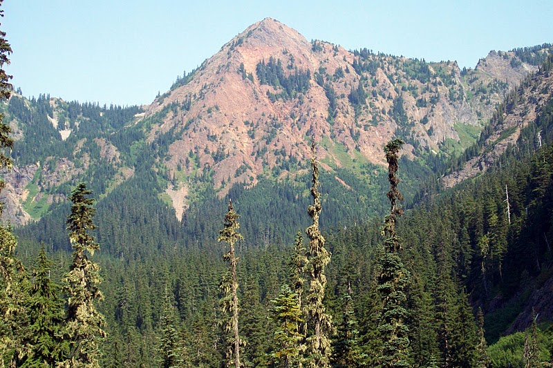 |
| Red Mountain and Red Pass to its left |
After the very late onset of the summer season this year, the pacific northwest has experienced a consistently beautiful sunny weather over last few weeks. In order to take full advantage of this blessing, I have abandoned my preference for a couple weeks to recoup from an arduous hiking trip, and in stead, started hiking every week I can get away. The Red Mountain can be seen from the I-90 highway at Snoqualmie Pass and has always fascinates me when I see it. So I set out for the Red Pass, which is a saddle between Red Mountain and Lundin Peak, over which the trail proceeds farther North down to the Middle Fork of Snoqualmie River valley.
 |
| Guye Peak and Snoqualmie Mtn viewed from PCT |
The trail starts at an elevation of 3000 ft at the Pacific Crest Trail (PCT) trail head at the Snoqualmie Pass just off of I-90 exit number 52 for East Summitt. The PCT runs from Mexico in the South all the way to Canada in the North along the crest of Cascade Mountain Range. This trail is a very popular hiking destination and appears to be well maintained. I headed North on a gently ascending trail for 2.5 miles after which at 4000 ft elevation, the Commonwealth Basin Trail starts leading to the Red Pass.
 |
| Red Lake |
Beyond the junction, the trail gradually descends by about 200 ft and ascends back to 4000 ft over about one and a quarter miles. I noticed the old Commonwealth Basin trail that has been abandoned and marked so. After this segment with relatively mild gradient, the trail climbs up rapidly to 4900 ft over numerous switchbacks in about three quarter of a mile. At this point there is a short detour the Red Lake at the foot of Lundin Peak. I took a a short detour to have a look. It appears as a serene water body with steep mountain slopes almost on three of its four sides.
 |
| Wild flowers |
Beyond the Red Lake, the trail embraces the huge rockfall area with lose rocks on the west face of Red Mountain. After another half mile, I finally arrived at Red Pass at an elevation 5300 ft. Immediately to the north is a precipice. A ridge line on either side runs to the Red Mountain and Lundin Peak while the trail first runs West and then continues North descending on the east face of Lundin Peak. The location provides spectacular view of the 6554 ft high Mount Thompson. I soaked up the views all around and took pictures while eating my lunch.
 |
| Mount Thomson viewed from Red Pass |
On my way back, I looked for a trail for getting to the Red Mountain summit. The large rock fall area with small sized rocks seemd to be a dangerous option, for it seems a pretty unstable route and you would not want anyone above you dislodging rocks that are precariously in place. The most obvious possible trail to the summit seemed to be a blocked trail near the detour to the Red Lake. To get to the summit, I would want with me someone who had made it before. That would be something for the future.
 |
| Loose rocks on Red Mountain west wall |


The whole experience seems to be an exiting one. The writing is nice and the pictures are very natural and beautiful.
ReplyDelete